Présentation de La Flèche
La ville de La Flèche se trouve dans le département français de la Sarthe (72) en région Pays de la Loire.
La Flèche compte environ 15 400 habitants, sa superficie est de 74.21 km². Son altitude par rapport au niveau de la mer est comprise entre 23 et 103 m.Sa densité de population était de 203 hab./km² en 2010 (Source INSEE)
Code postal de La Flèche: 72200
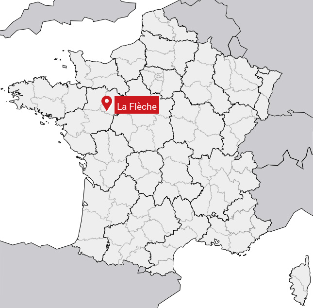
Localisation en France
Département et Région: (72) Sarthe, Pays de la LoireÀ voir à La Flèche
Monuments historiques
Il y a 7 monuments inscrits au patrimoine historique à voir à La Flèche.
Chapelle Notre-Dame-des-Vertus72200 Flèche (La)  |
Halle-Mairie72200 Flèche (La)  |
Hôtel Huger de Vernelles (ancien)Vernevelle (rue de) 10, 72200 Flèche (La)  |
Monastère de la Visitation (ancien)Henri-Dunant (rue), 72200 Flèche (La)  |
Pavillon carréGrollier (rue) 17, 72200 Flèche (La)  |
Ancien collège des Jésuites, actuellement Prytanée72200 Flèche (La)  |
Eglise Sainte-Colombe72200 Flèche (La)  |
Tout afficher
Avis des habitants 0
Aucun avis. Soyez le premier à laisser votre avis.
Informations sur La Flèche
Code INSEE: 72154 - Nom SOUNDEX: L142 - Nom METAPHONE: LFLX
Population de la commune:
Population en 1999: 15 242 habitantsPopulation en 2010: 15 087 habitants -0.09%/an
Population en 2016: 15 006 habitants (Estimation)
Carte
Coordonnées GPS de La Flèche en degrés: Latitude: 47.7° Longitude: -0.083333°
Communes aux alentours
- Arthezé (72) à 9.6 km
- Saint-Quentin-lès-Beaurepaire (49) à 8.3 km
- Villaines-sous-Malicorne (72) à 7.5 km
- Clefs (49) à 9.3 km
- Bousse (72) à 7.8 km
